From the archive In brief
UN General Assembly backs Equal Earth map to show Africa at its true size
A non-binding resolution adopted on 4 September 2026 by 164 votes to one asks governments, schools and technology companies to stop relying on maps that shrink the continent.
- Event date
- Published
- Reading time
- 1 min
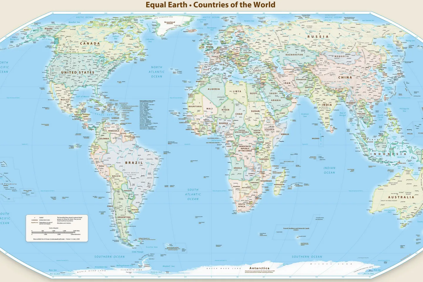
On the Mercator map still common in classrooms, media and apps, Greenland can look roughly as large as Africa. Africa is in fact about 14 times larger. On Friday 4 September 2026 the United Nations General Assembly adopted a resolution asking the world to use maps that show the difference.
The text, titled “Correct the map” and introduced by Togo on behalf of the African Group, passed by 164 votes to one with six abstentions, according to the UN’s record of the meeting. The United States cast the only vote against. Estonia, Georgia, Lithuania, Moldova, Serbia and Ukraine abstained.
The resolution is not binding, and it does not ban anything. It encourages governments, schools, international organisations and technology companies to use equal-area projections, in particular the Equal Earth projection developed in 2018, wherever the relative size of continents matters. Its target is the Mercator projection, devised by the Flemish cartographer Gerardus Mercator in 1569 for navigation at sea. Mercator’s map keeps compass directions straight but enlarges land the further it lies from the equator, which inflates Europe and North America and diminishes Africa and South America.
“A fair map does not change the geography of the world, it changes how we see the world,” Togo’s foreign minister, Robert Dussey, said before the vote.
The US representative said the resolution “mocks the work and purpose of this institution” and objected to its references to reparations and “cognitive justice”, calling such texts “barnacles on our work here”.
Ukraine’s abstention had a different cause. Its delegate supported the aim but said that some Equal Earth maps depict Ukrainian territory occupied by Russia in a way Kyiv cannot accept. Ireland, speaking for the European Union, supported the text’s aim and said it concerns only the relative size of landmasses and has no bearing on sovereignty or borders.
France’s foreign minister, Jean-Noël Barrot, announced hours before the vote that France would stop using Mercator for its world maps, UN News reported.
Sources
- General Assembly Adopts Text to 'Correct the Map', among Others Proclaiming Decade of Culture for Sustainable Development, Child Marriage Elimination Day
- UN tells the world: Stop making Africa look small
- UN General Assembly endorses new world map that shows more accurately Africa's size
Spotted an error? See how to request a correction.